
Type of territory: active combat zone
Population: 988
Area of municipality: 412.689 km²
Priority project:
There are no projects
Additional peculiarities of the municipality:
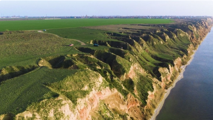
Situated on the shore of the Dnieper Estuary, the Stanislav municipality has an advantageous geographical location that creates convenient transport connections between the regional centres of Kherson and Mykolaiv. The municipality comprises four settlements, with the village of Stanislav serving as its administrative centre alongside Shyroka Balka, Oleksandrivka, and Sofiivka. Representing the area's main potential, agricultural land makes up 48.4% of the municipality's territory. Furthermore, the picturesque landscapes of the Stanislav Cliffs, the Stanislav Grand Canyon, and the estuary offer great opportunities for tourism, though active hostilities following the russian invasion have temporarily halted the development of this sector. Once the security situation improves and reconstruction begins, the municipality plans to implement its pre-war projects, which include building a port in Oleksandrivka and installing windmills.
Contact: Ms Svitlana Symonyants, Specialist in Municipal Initiatives and Investments, svitlanasimonanc@gmail.com